It’s not somewhere you’d think to go if you didn’t live there, but you’d be missing out! No other district in Utrecht manages to combine nature and history quite like Lunetten. You pass ancient forts, unique flora and fauna, and architecture that takes you back to the 1970s and 80s.
By Pam van der Veen
Tucked away in the furthest south-east corner of Utrecht, neatly framed by Waterlinieweg, the railway and the A12 motorway, Lunetten was built in the 1970s as an overspill after the Hoograven, Kanaleneiland and Overvecht districts. Once the worst of the housing shortage had been resolved, it was time to think about how to organise arrange the public space and social cohesion in this new neighbourhood. To ensure a diverse population, various types of housing were built, ranging from rooms and apartments to duplex houses and terraced properties. Residents were even invited to plan the lay-out of some of the houses – consultation was ‘in’ in those days. The fact that they could claim to live in the Carpathians, the Shetlands, the Dolomites or the Philippines (the Dutch street names in Lunetten largely refer to mountain ranges or island groups), made things even more fun.
‘Cul-de-sac’ neighbourhood
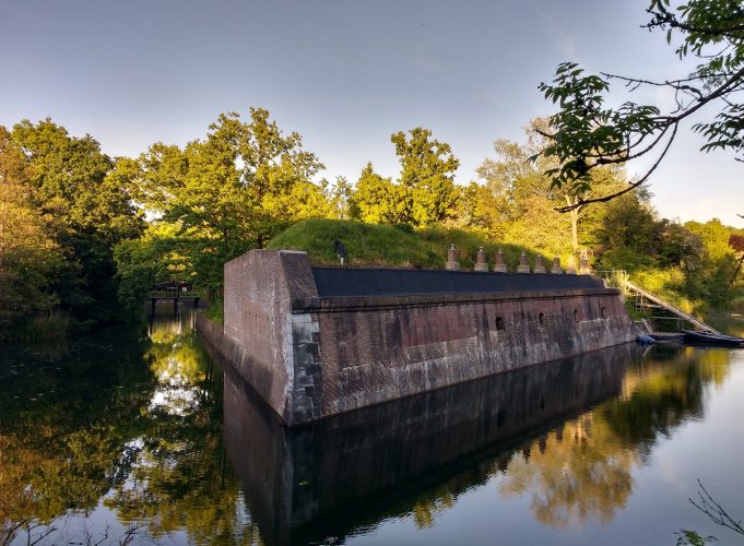
Lunetten is a good example of the type of ‘cul-de-sac’ neighbourhoods that were built at that time. The ring roads (Simplonbaan, Furkabaan and Brennerbaan) with labyrinths of cul-de-sacs and closes on either side, determine the basic structure of the neighbourhood and restrict the flow of traffic. If you look at a map of the neighbourhood, you can see that it resembles a cauliflower, which explains the Dutch name for this type of housing estate (bloemkoolwijk). As was the way in the 1970s, new housing estates like this had plenty of space for parks, water, playgrounds and canals with bridges. The village-feel is still in evidence, despite being just 15 minutes from the centre of Utrecht by bike. The nice thing about walking through Lunetten is the way that the design of the houses matches the original landscape and the historical fortifications that still exist. The New Dutch Water Line, the Netherlands’ largest national monument, runs straight through Lunetten. The two forts which the neighbourhood was named after, Lunet III and Lunet IV, play a prominent role as a childcare and scouting facilities, and as a venue for events and hospitality. The historical inundation canal, built by Napoleon in the early 19th century to transport water from the Vecht and Kromme Rijn rivers to the forts, still plays an important part by linking the northern Beatrixpark with the southern De Koppel Park. An idyllic footpath runs alongside it.
Urban farm
We start at the ‘main entrance’ to the neighbourhood, at the foot of Rob Birza’s work of art, which has been welcoming residents and visitors since 1999. It is shaped like an enormous mushroom, and stands on a plinth that looks like a temple. It’s called Temple of Boom and is the ultimate proof that you’ve arrived in Lunetten. From this orientation point, we walk towards Oude Liesbosweg, which takes us along a leafy path beside the inundation canal, past wooden suspension bridges and the Utrecht-Zuid allotment complex, which was there long before Lunetten was built. The canal comes to a dead end at the A12 barrier, but the path bends eastwards through the woods in De Koppel Park. The chirruping of blackbirds, tits and finches dims the roar of the motorway to background noise. Pass the De Kuil playground and you’ll see De Koppelsteede urban farm, where you can visit the animals. An old orchard serves as a reminder of Lunetten before it was built on.
Street art
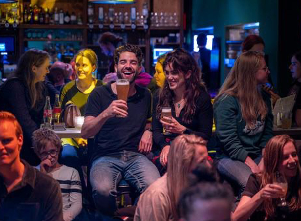
Koppeldijk is a long narrow lane with poplars on either side. It takes us to the residential part of Lunetten. The path ends in Goeree, with a work of art called De Dam by Bas Maters, dating from 1982. He designed a mini landscape of grey stone corners and points, fanning out to a canal. The water could be cleaner, but De Dam is a popular spot for playing. Follow Liemers to Graafschap 47, where the Utrecht street-artist JanIsDeMan left one of his famous wall paintings: de woordzoeker. It consists of a collection of words from stories recounted by local residents. You can read more about these stories and the work of art on the muurschilderinglunetten.nl. website. We walk back to the water and head for Hondsrug, which is the Lunetten shopping centre. It looks a bit neglected, despite the best efforts of a picture called Een berg voor Lunetten by the artists Krijn Christiaansen and Jelske de Beer. You’ll find plenty of places for take-away food and drink here,. If the weather’s nice, you can take your spoils and have a picnic in Beatrixpark, our next destination.
Spotting kingfishers
We return to nature via Gaasterland, walking towards the ash trees, willows, oaks, hazelnut trees and blackthorn bushes. Above the sound of traffic on the adjoining Waterlinieweg, you can sometimes hear woodpeckers high up in the trees. Fort Lunet III is in the north-west corner of the park, surrounded by a ‘moat’. The banks are inhabited by grass snakes, frogs and water voles. If you’re lucky, you might even spot a kingfisher or an orchid. We veer southwards, and the path takes us past Fort Lunet IV and De Smaak van Lunet lunch café. A path across the fort gives a great view of the historical fortifications. We now go under the bike and pedestrian tunnel, admiring the ceramics made by young people from the neighbouring Hoograven district, and continue along the water towards our starting point. And there it is, the huge mushroom, looming up like a beacon for the neighbourhood we’ve just left behind us. Cross the Lunettenbrug, onto ’t Goyplein, and we’re back in the hustle and bustle of the city, far from the peace of ‘village life’.